ThayerMahan and PanGeo Subsea Sign MoU to Provide Enhanced Seabed Survey Technologies
Seabed Survey Partnership to Provide the Full Range of 3D SAS Imagery to De-risk Seabed Construction Operations
Groton, Connecticut (March 23rd, 2020) – PanGeo Subsea Inc. and ThayerMahan Inc. recently executed a cooperative partnering agreement to provide a complete suite of state-of-the-art seabed and sub-seabed survey technologies to reduce risk and provide unsurpassed 3D acoustic imagery to clients in the offshore energy industry, to national security stakeholders, academia and the scientific communities.
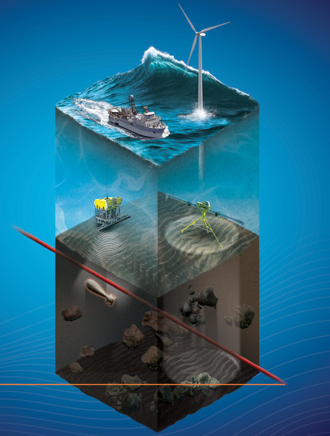
PanGeo Subsea offers two acoustic survey technologies –the Sub-Bottom Imager™ and the Acoustic Corer™ that penetrate the seabed floor to depths of 20-30 ft and 120 ft respectively to provide true real time 3D visualization of buried geohazards. ThayerMahan is a world leader in providing autonomous maritime and seabed survey solutions. ThayerMahan personnel have over 250+ years of maritime operational experience in the most challenging seaborne environments. ThayerMahan provides high-speed, large swath, precision, low-cost seabed surveys from vessels -large and small. PanGeo's sub-seabed imaging technologies will augment ThayerMahan's current seabed survey capabilities to provide the full range of surveying services necessary to safely conduct marine installations.
PanGeo Subsea's imaging technology can identify sub-seabed hazards using real time 3D volumetric Synthetic Aperture Sonar data
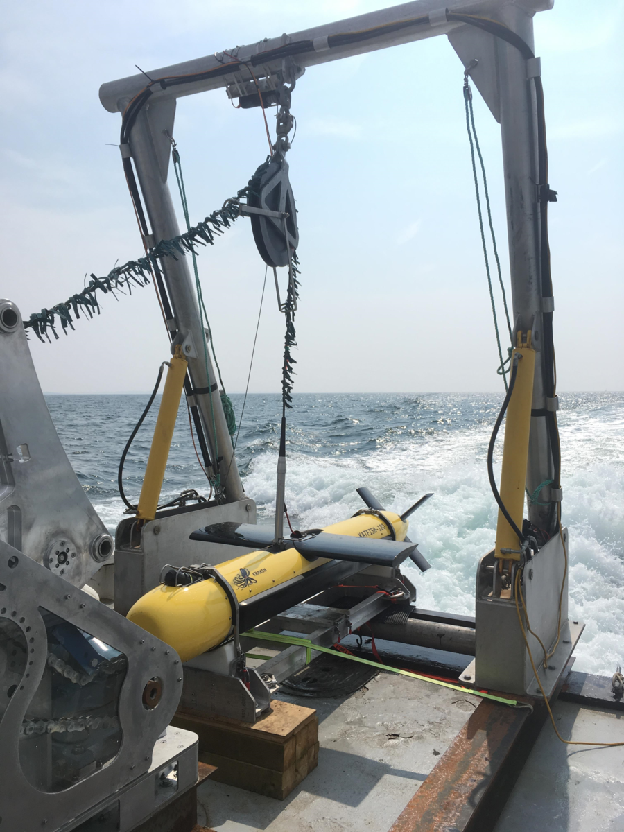
ThayerMahan SeaScout uses an actively stabilized towfish and Synthetic Aperture Sonar to produce high resolution, real-time seabed imagery at high speed from vessels large and small
ThayerMahan CEO Mike Connor stated:
"We are proud to be teaming with PanGeo. This partnership combines ThayerMahan's ability to conduct high-speed, high-precision seabed search with PanGeo's ability to investigate sub-seabed conditions using cutting edge technology. Together, we provide a more complete service offering to our customers in government, industry, and academia."
PanGeo Subsea CEO Moya Cahill said:
“PanGeo is excited for this partnership with ThayerMahan. PanGeo is a global leader in high resolution 3D SAS sub-bottom imagers. We are happy to bring PanGeo's risk mitigation solutions to the US offshore renewable sector with ThayerMahan and look forward to building upon the success we've enjoyed as part of the Block Island and South Fork offshore wind farm projects. We are confident this partnership between PanGeo and ThayerMahan will strengthen our respective positions to deliver leading edge survey solutions for UXO, pre-route, depth of burial and pile foundation clearance surveys.
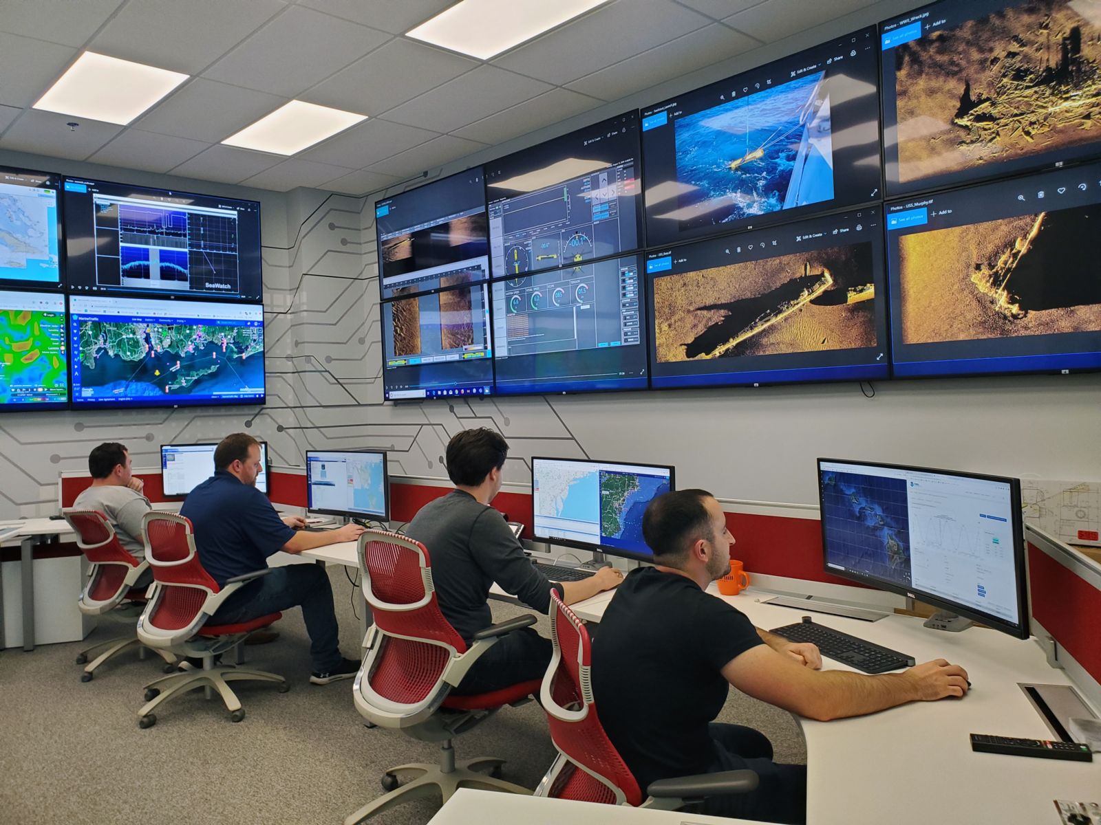
ThayerMahan personnel can control and monitor seabed survey operations from their Operations Center in Groton, CT
Media Contacts
Richard J. Hine
ThayerMahan
Chief Operating Officer rhine@thayermahan.com
860-937-6622 (Office)
About ThayerMahan
ThayerMahan, Inc. is a maritime technology company dedicated to providing its government and commercial clients with turn-key (including deployment, operations, data gathering and analysis services) autonomous marine solutions using state-of-the-art acoustic and electronic sensors integrated on a variety of host platforms tailored to specific mission criteria. The company is headquartered in Groton, CT with satellite presences in Boston and Washington, DC. For more information, please visit www.thayermahan.com or contact directly at info@thayermahan.com.
About PanGeo Subsea
PanGeo Subsea, Inc. is a marine geophysical-geotechnical service delivery company specializing in high resolution true 3D volumetric acoustic imaging solutions to mitigate risk in offshore installations. PanGeo offers a technology solution to clients that supports accurate positioning and continuous visualization of cables and pipelines during depth of burial surveys; helps identify buried anomalies threatening integrity of pipe/cable in parallel with depth of burial survey; and provides true 3D volumetric imaging and accurate positioning of buried infrastructure for efficient site decommissioning. The patented technology interrogates the sub-seabed to provide a 3D image of the position of buried anomalies like boulders and Unexploded Ordnances (UXO) (including ferrous and non-ferrous) that support de-risking and micro-siting of offshore installations. Corporate headquarters are in St. John's, Newfoundland & Labrador, Canada with operations in Aberdeen, UK, and Dartmouth, Nova Scotia, Canada and a sales office in Boston, Massachusetts. For more information, please visit www.pangeosubsea.com or contact directly at sales@pangeosubsea.com.